$45
/person25% Off
Suspension Bridge
Quisque cursus finibus lectus, at dignissim mi congue ac.
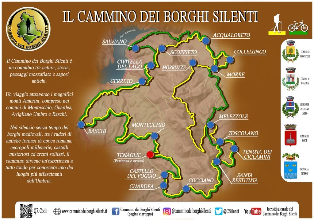
The walking route is about 90 km long and is mainly on dirt roads, mountain paths and some short sections of secondary paved roads. The Cammino dei Borghi Silenti is traced as a loop and revolves around Mount Croce di Serra, the highest point in the Amerini Mountains with its almost 1,000 meters in height; it is necessary to carefully follow the yellow-colored signs, as per the legend, since the trail runs through large uninhabited stretches with long passages through the woods. Generally, the trail can be done by anyone with a fair amount of training, as there are no technically difficult sections but only, as is obvious, a bit strenuous. It is advisable to assess well one's physical capabilities and the training one has, however there is always the possibility of being able to shorten or lengthen the stages at one's leisure; in 3 - 4 days for the most trained and athletic, 5 - 6 - 7 days for the less trained who want to walk it in peace, organizing themselves through the paper guide and the schematic sheet with updates attached to it; order them by clicking the orange button.
Vim quando recteque at, vel amet utinam intellegam ut, quo deleniti democritum ut. Petentium omittantur ad duo, cu phaedrum deserunt.